
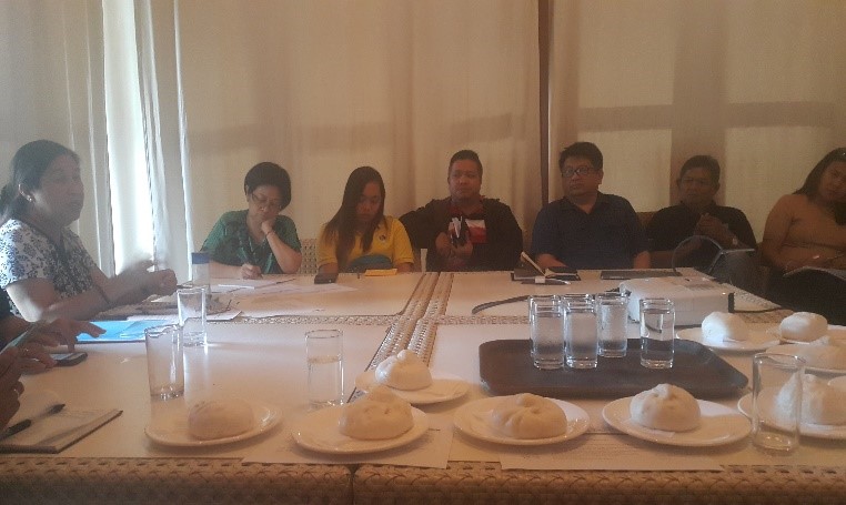
The Mines and Geosciences Bureau Regional Office No. XIII took part in the Inception Workshop on the Integrated Approach in the Management of Major Biodiversity Corridors in the Philippines Project on August 23-24, 2018 at the Almont Inland Resort in Butuan City.
The workshop was hosted by the United Nations Development Programme (UNDP). It was participated by Technical Working Groups (TWGs), government agencies (Regions XI & XIII), non-government agencies and members of the academe within Key Biodiversity Area (KBA) clusters.
The purpose of the inception workshop was to level off with the stakeholders and to solicit valuable inputs and recommendations regarding the finalization of the project concept and design. The proponent will also conduct technical and scientific studies based on actual and realistic situation through baseline analysis or spatial analysis of the proposed KBA clusters.
On August 23, the Assistant Secretary of Biodiversity Management Bureau presented the Rationale of the Integrated Approach to the Management of Major Biodiversity Corridors in the Philippines. It was then followed by the UNDP consultants’ presentation on Enhancing Biodiversity, Maintaining Ecosystem Flows, and Enhancing Carbon Stocks through Sustainable Land Management and the Restoration of Degraded Forestlands, and Integrated Approach in the Management of Major Biodiversity Corridors in the Philippines.
The presentation on Rationale of the Integrated Approach to the Management of Major Biodiversity Corridors in the Philippines discussed the following topics:
- Brief Overview of Biodiversity;
- Philippine Biodiversity;
- Ecosystem Diversity particularly the Caimpugan Dome in Agusan del Sur;
- Philippine Ecosystem and Biodiversity Values Ecosystem Services; and
- Salient points of Philippine Biodiversity Strategy and Action Plan (PBSAP); Policies that can potentially affect Biodiversity Corridors: Republic Act No. 7942 (Philippine Mining Act of 1995), DENR Administrative Order No. 99-53 (Regulations Governing the Integrated Forest Management Program); and Caraga Regional Development Plan relevant to Project Preparation Grant (PPG) of Biodiversity Corridors.
The presentation on Enhancing Biodiversity, Maintaining Ecosystem Flows, and Enhancing Carbon Stocks through Sustainable Land Management and the Restoration of Degraded Forestlands elaborated on the following:
- The relationship of the three organizations namely Global Environmental Facility (GEF), Food Agriculture Organization (FAO), and Environment Sustainable Biodiversity Organization;
- Criteria for Project Site Selection;
- Multiple environmental and social benefits mainstreamed into the Government’s large investments in reforestation and forest restoration; and
- Possible Enhanced National Greening Program (ENGP) “models” established through the project.
The presentation on Integrated Approach in the Management of Major Biodiversity Corridor in the Philippines discussed the following:
- Biodiversity Focus;
- Corridors Project;
- Habitat Preference;
- Species Distribution Model; and
- Eastern Mindanao Biodiversity Corridor.
During the UNDP consultants’ presentations, a thematic map of KBA clusters based on the 2010 baseline data spatial analysis that delineates areas in Regions XI and XIII which have potential for biodiversity was shown. Most of the clusters in the aforementioned regions are within MPSA areas and other tenurial instruments. With this, the consultants presented the No Net Loss (NNL) approach for accessing and mitigating the impact of projects on High Conservation Values (HCVs) that include the MPSA areas. The NNL approach utilizes the mitigating hierarchy of avoidance, minimization, rehabilitation, and offsetting if there is a residual impact.
During the plenary discussion of the morning session, the following topics were talked through:
- Construction of road networks must be considered;
- Enhancement of Environment Impact Assessment (EIA);
- Steering committee on handling tenurial instrument overlapping included;
- Peace and order situation in the areas must be identified; and
- Application of exploration activities KBA must be included.
In addition, the balance of Mineral Reservation vis-a-vis Biodiversity Conservation hang on to this discussion.
In the afternoon, the DENR and line agencies/bureaus group tackled the cluster programs, projects, and activities as shown below:
| CLUSTER 2 Surigao del Norte, Agusan del Norte (Cabadbaran City and Butuan City), Surigao del Sur (Tandag City), and Agusan del Sur |
CLUSTER 3 Surigao del Sur and Agusan del Sur (Bayugan City and Municipality of San Francisco) |
CLUSTER 4 Surigao del Sur (Bislig City) and Agusan del Sur |
CLUSTER 6 Hamiguitan (Davao Oriental) |
|
|
|
|
 The other group exclusively focused on consultations and discussions with mining companies. The UNDP consultants delivered the same platform of presentations directly addressed to mining stakeholders. The meeting was participated by the following mining companies:
- Austral-Asia Link Mining Corporation;
- Marcventures Mining and Development Corporation;
- Platinum Group Metals Corporation;
- Philsaga Mining Corporation;
- Mindanao Mineral Processing and Refining Corporation;
- Taganito Mining Corporation;
- CTP Construction and Mining Corporation (Dahican and Adlay Projects); and
- Carrascal Nickel Corporation.
The highlights of the meeting with mining companies are the following:
- Recommendation to use updated spatial information. However, PPG Team uses only official data as of 2010 (NAMRIA Map). There might be other root causes of biodiversity loss other than mining activities;
- Engagement of all stakeholders in decision-making process that would also benefit the communities;
- More scientific restoration activities with participation of various sectors;
- Key maps to be overlaid in the tenement areas; and
- Capacity building on biodiversity conservation not only for mining companies but for MGB and EMB as well.
On August 24, the National Economic and Development Authority Regional Office Nos. XI and XIII and Mount Hamiguitan Range Wildlife Sanctuary gave presentations.
NEDA Regional Office No. XIII presented Rationalizing Mining Activities in Caraga Region with the following discussions:
- Land area and classification;
- Topography and climate;
- Natural Resources;
- Demographic Profile;
- Economy;
- Labor and Employment;
- Major Challenges in Development; and
- Observations, findings, and recommendations.
The presentation of NEDA Regional Office No. XI was all about the Region’s Highlights with the following topics:
- Background Information;
- Regional Forest Cover by Province;
- Potential Area for Development; and
- Accomplishment Monitoring Form on Maintaining Ecological Integrity and Clean and Healthy Environment.
The Mount Hamiguitan Range Wildlife Sanctuary presented Harnessing Stakeholders Participation in the Management of Protected with the following discussions:
- Mount Hamiguitan Range Wildlife Sanctuary Experience;
- Asean Heritage Parks;
- Key Features – Biodiversity Features; and
- Noteworthy practices undertaken by the respective stakeholders of Mount Hamiguitan Range Wildlife Sanctuary (MHRWS).
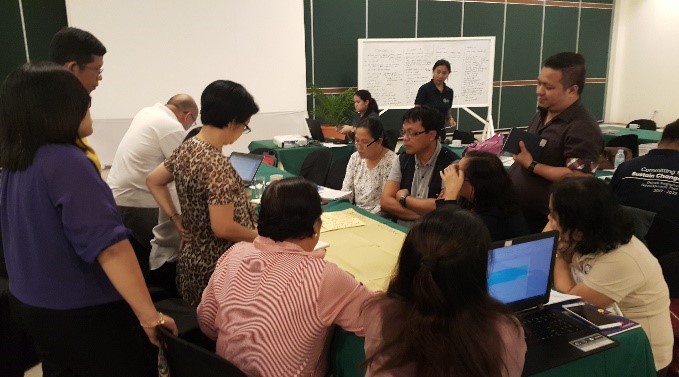 In the afternoon, the Barista Workshop was conducted wherein the participants were grouped into four café bars such as the Institution Coordination Mechanisms Café Bar; the Treats, Risks, and Assumptions GEF-assisted Project Implementation Café Bar; the Local Level Initiatives of Government Environment Facility (GEF) Assisted Project Build-on Café Bar; and the Community-based Initiative Café Bar. Various programs, projects and activities were explored and discussed during the said workshop. The workshop concluded with the brief presentations on respective matters discussed by each group.
The inception workshop culminated in a photo session.