
Personnel of the Geosciences Division of Mines and Geosciences Bureau Regional Office No. 13 conducted the Vulnerability and Risk Assessment, Groundwater Resource Assessment and Geohazard Identification Survey on April 14 to 30, 2016 in the Province of Surigao del Sur.
On April 14, 2016, the GSD team paid a courtesy call on the Local Government Unit of Bislig City to inform the officials that they will conduct the Vulnerability and Risk Assessment and Geohazard Identification Survey in a subdivision by the National Housing Authority (NHA).
The team and the City Disaster Risk Reduction Management Officer, Mr. Orbele A. Carmen, produced a schedule of target barangays per working day. The geologists and geologic mappers also met with Engr. Jovino J. Requina, Jr., City Engineer, to discuss about the Geohazard Survey request for NHA Bayside Subdivision Housing (Phase II). The team was divided into 3 groups. One group conducted the geohazard survey while the other two groups started the Vulnerability and Risk Assessment in Barangays San Jose and Pamanlinan. No problems were encountered during the fieldwork since some barangays were already informed of the assessment.
After the survey in 24 barangays, the GSD team proceeded to the Municipality of Barobo to conduct Vulnerability and Risk Assessment and Groundwater Resource Assessment. The Municipal Disaster Risk Reduction Management Office of Barobo headed by Ms. Kathreen Donna Joy M. Siega, MDRRMO Designate, assisted the team in planning the survey schedule in each barangay. Three personnel from their office volunteered to guide the team in assessing 21 barangays.
On April 23, 2016, an accident was reported to the team regarding the open pit slope failure of a small-scale mining activity in Barangay Tambis where 3 persons were killed after they were buried in a landslide. An incident report was immediately submitted to the Mine Management Division of MGB ROXIII. The GSD team, together with MDRRMO personnel, met with Mayor Felixberto S. Urbiztondo to discuss about the progress of the assessments and also the action taken by MGB ROXIII regarding the incident. Another team from MMD was sent to the area of incident to conduct a detailed investigation. The Vulnerability and Risk Assessment and Groundwater Resource Assessment were completed by the GSD team on schedule. After the exit conference with Mayor Urbiztondo, the team went back to Surigao City.
The detailed flood and landslide geohazard assessment of the 1,634 cities/municipalities of the entire country was already completed in 2014. Last year, the Vulnerability and Risk Assessment Project is introduced as a new activity or an expansion of the geohazard assessment program of the Mines and Geosciences Bureau. To further optimize the usefulness of the geohazard map, Vulnerability and Risk Assessment was undertaken over the highly critical and priority areas of the country. MGB ROXIII has twelve (12) target municipalities/cities this year. Vulnerability and Risk Assessment is conducted by acquiring GPS readings of important structures in the barangay such as day care centers, barangay hall, evacuation center, schools, etc. Purok centers and purok/barangay boundaries were also tracked. Type of house materials and means of transportation were also noted. Another important data to be acquired from the barangay secretary is the barangay demographic profile including the population.
The Vulnerabilit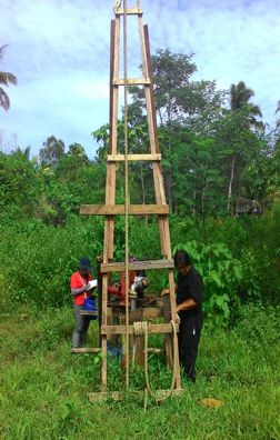 y and Risk Assessment is a critical input to the regional, provincial and local disaster preparedness, management and mitigation plans and land use plans. It provides technical inputs to Local Government Units for updating and modification of the Comprehensive Land Use Plans (CLUPs), project development and disaster preparedness, management and mitigation programs. The expected impact of the Vulnerability and Risk Assessment Project to the community is zero or minimal casualties during flood and rain-induced landslide.
The Groundwater Resource Assessment Program is one of the functions of the Mines and Geosciences Bureau which started last year. For this year, MGB Region 13 has fifteen (15) target municipalities within the Province of Surigao del Sur. This program aims to update and assess groundwater resources by province in the entire country. The first phase of Groundwater Resource Assessment was conducted by doing well and spring inventory in each barangay. The sources or potential sources of water supply for the entire neighborhood or town were also located. This program can establish the current conditions regarding the quantity and quality of groundwater resources in the Philippines. It will also complement and enhance the technical capabilities of water agencies in the country. The output also recommends mitigating measures to lessen the level of risk posed to groundwater resources.