
Karst subsidence and sinkhole collapse are some of the most dangerous hazards that can happen in an area underlain by carbonate lithology. The term karst describes a distinctive topography that indicates dissolution (also called chemical solution) of underlying soluble rocks by surface water or ground water. Although commonly associated with carbonate rocks (limestone and dolomite) other highly soluble rocks such as evaporites (gypsum and rock salt) can be sculpted into karst terrain (Alpha, T.R., et.al).
The Mines and Geosciences Bureau Regional Office No. XIII conducted the Karst Subsidence Hazard Susceptibility Assessment and Ground Penetrating Radar (GPR) Survey on June 16 to August 13 in the Municipality of Tagbina, Surigao del Sur as its sole target for 2019.
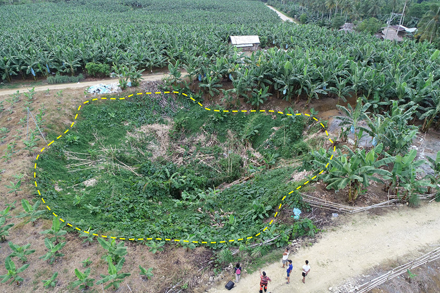
A team of geologists and geologic aides from the Geosciences Division conducted the said assessment and survey. For the first two weeks, the team focused on sinkhole and cave opening inventory in the twenty-five barangays comprising the municipality. The team was then subdivided into two groups to increase efficiency. Aerial shots were taken with a drone to acquire a better and wider perspective of the sinkholes. From the third week until the remaining weeks, the Ground Penetrating Radar (GPR) Survey was conducted in areas identified from the previous sinkhole inventory to be given priority for GPR Survey. Priority areas include sinkholes or cave openings located along/within/near but not limited to residential areas, schools, government facilities, road networks, proposed barangay sites and geotourism sites.
After the on-site survey, the interpretation of fieldwork results followed. The GPR equipment produces a radargram which is an image representing different signatures and anomaly within the subsurface that were collected by the equipment during the survey. This image is then transferred to a computer to be analyzed and to filter the unnecessary noise that was collected. From here, sinkholes such as hollows, cave systems and other subsurface materials such as metals, tree roots and the type of rock can also be identified with the right approach.
After the GPR survey has been conducted in all barangays, the team informed the Local Government Units (LGUs) of Tagbina of the initial results including the inventory of sinkholes per barangay and the sinkholes identified by the GPR survey.