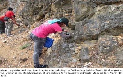
In line with this year’s target of the Mines and Geosciences Bureau, personnel of MGB ROXIII-Geosciences Division participated in the Workshop on the Standardization of Methodologies for the Geologic Quadrangle Mapping of Region 3 conducted by MGB Central Office on March 7 to 10, 2016 at the Contemporary Hotel in Manila. The workshop aimed to standardize the methodologies to be used and discuss the necessary procedures to be done such as rock sampling and appropriate map symbols. Every team (ROs and CO) was given 2 quadrangles ̶̶̶̶ one raw quad and another quad for updating. The four-day workshop included presentations of various resource speakers and selected MGB technical personnel. Discussions and agreements on the standard methods were made during the workshop. On the fourth day, a field practice was conducted in Tanay, Rizal. After the workshop, the teams proceeded to their assigned areas. The MGB ROXIII-GSD team mapped the Malolos continue reading : MGB ROXIII-GSD team conducts Geologic Quadrangle Mapping
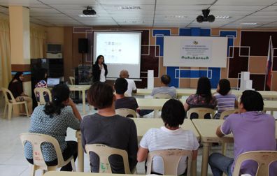
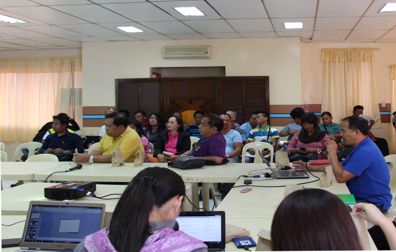
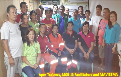
In compliance to the MGB Programs/Projects/Activities (P/P/As) on Small-Scale Mining, a Training for Masabong Village Small-Scale Miners Association (MAVISSMA) on Rescue, Safety and Environmental Protection was conducted last April 20-22, 2016 at Sitio Masabong, Bayugan 3, Rosario, Agusan del Sur. The training was participated by 26 miners of MAVISSMA. The trainers composed of the Technical Personnel from Apex Mining Co., Inc. (AMCI) namely: Steve John Bagacay – Conventional Mining Eric Maningo – Conventional Mining Edu Seguerra – Rescue and Safety Induction Danilo P. Regis – Environmental Protection While the MGB-13 Training Facilitators are: Ana Diosell Soliven-Bajao, Economist-II Engr. Ernesto C. Calzar-Engr. II Carl Orven C. Eludo, Planning Officer Mitch Bryll H. Tampus During the training, the team conducted a gold tunnel evaluation to see the actual practices of the miners. Before the training schedule, Ms. Ana Soliven-Bajao and Engr. Ernesto Calzar visited Apex Mining Co., Inc. in Masara, Maco, Compostela continue reading : Training for MAVISSMA Small-Scale Miners with Trainers from APEX Mining Co., Inc.