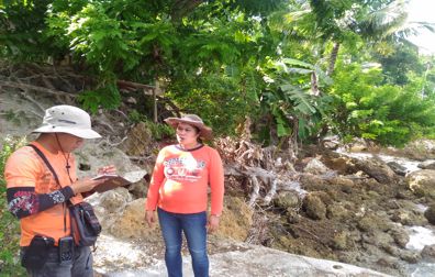
After the completion of the geohazard mapping and assessment of landslide and flood-prone areas, the Mines and Geosciences Bureau is now conducting the geaohazard mapping and assessment of the country’s coastal areas. A team of geologists and mapper from the Geosciences Division of MGB Regional Office No. XIII conducted the Coastal Geohazard Mapping and Assessment from July to August 2016 in southern coastal municipalities in the Province of Cebu as assigned by MGB Central Office. The fieldwork was divided in two phases. Five municipalities were covered during Phase 1 which was conducted from July 6-25, 2016 while four municipalities were covered during Phase 2 which was carried out from August 11-30, 2016. During the 1st phase of the fieldwork, the team assessed the coastal municipalities of Boljoon, Oslob, Santander, Ginatilan and Malabuyoc. The coastal areas in the Municipalities of Alegria, Badian, Moalboal and Alcantara were surveyed during the 2nd phase continue reading : MGB ROXIII conducts Coastal Geohazard Mapping and Assessment